
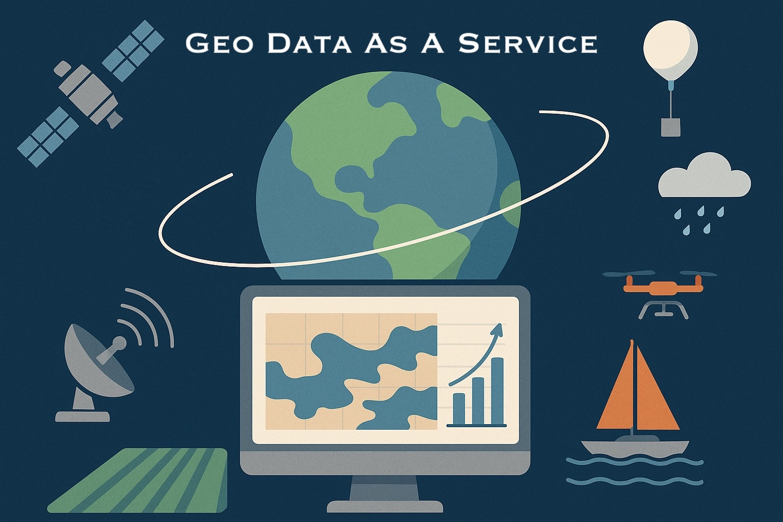
GeoAI Unpacked #4: The Rise of Geospatial Data-as-a-Service

Welcome to GeoAI Unpacked! I am Ali Ahmadalipour and in this blog, I share insights and deep dives in geospatial AI, focusing on business opportunities and industry challenges. Each issue highlights key advances, real-world applications, and my personal takeaways on emerging opportunities. For a sneak peak at the topics I plan to cover in upcoming issues, visit here.
In this issue, I’ve explored the rise of data-as-a-service (DaaS) in the geospatial sector. We’ll look at how the industry has shifted from public data programs to a growing ecosystem of private data providers, the business models behind them, and the opportunities and challenges shaping this evolving market. Let’s dive in!
1. The Changing Face of Geospatial Data
The concept of selling geospatial data isn’t new. In its early forms, “data as a service” largely meant delivering post-processed datasets; a weather forecast API for an energy company, a climate risk layer for an insurer, or a bulk download of flood maps for a government agency. The data was already cleaned, packaged, and ready for use, and customers paid for the convenience of not having to source and process it themselves. Governments like NASA and NOAA led most data acquisition efforts (in the US), launching billion-dollar satellite missions and making the data freely available to everyone.
Today, that landscape looks very different. The private sector is increasingly in the driver’s seat; from Planet’s daily Earth imagery and Maxar’s ultra-high-resolution satellites, to Windborne Systems’ weather balloons drifting across the stratosphere, and Saildrone’s autonomous boats patrolling the oceans. These companies don’t just collect data; they sell it directly to governments, researchers, and businesses, sometimes bypassing the traditional public-sector-led pipeline altogether.
It’s part of a much larger shift: the geospatial data market is moving away from “public good” toward a competitive, commercially-driven ecosystem. While this shift raises questions about access, pricing, and the balance of power between those who own the sensors and those who need the insights, it’s also creating entirely new business opportunities. This article explores that changing landscape, from raw data sales to full decision-making solutions, and the opportunities and challenges that come with it.
2. A New Era of Geospatial Providers
A big leap in the geo data service came with the rise of private satellite operators. Building on the groundwork laid by early innovators such as Planet and Maxar, many other satellite companies emerged across the globe. Companies like Capella Space, ICEYE, and Umbra began launching synthetic aperture radar (SAR) satellites capable of imaging day or night, through clouds and weather, offering capabilities that rivaled or even exceeded many government missions. Spire Global took a different route, focusing on radio occultation and maritime/aviation tracking data. FireSat, launched very recently, explored the niche of real-time wildfire detection from orbit, showing how targeted sensing could serve very specific use cases. We have passed a turning point; high-quality geospatial data acquisition is no longer the exclusive domain of billion-dollar public programs.
In recent years, the sector has expanded beyond satellites into specialized sensing platforms. Windborne Systems uses autonomous weather balloons to capture high-altitude atmospheric data for weather forecasters. Saildrone deploys ocean-going autonomous vehicles to monitor sea surface temperatures, marine ecosystems, and storm development. These niche platforms have broadened the definition of geospatial DaaS well beyond imagery, creating new market segments and value propositions.
3. The Business Model Spectrum
Not all geospatial data is sold the same way. Business models in the sector typically fall along a spectrum, from upstream raw data sales to fully packaged, decision-ready solutions.
Raw data sales – Selling unprocessed or minimally processed data has the lowest margins and is the easiest to commoditize, but it’s also the simplest to scale. It appeals to technically capable customers who want full control over how they use the data.
Analytics & insights – Higher margins and stronger customer stickiness, but requires deep domain expertise and ongoing investment in models, infrastructure, and data fusion. Many industries, such as insurance, skip raw feeds entirely and buy processed outputs. They’re not interested in a precipitation forecast per se; they want flood loss estimates, damage probability maps, or wildfire spread models that can feed directly into underwriting, claims, or risk management workflows.
Full solutions – The far end of the spectrum is offering direct, actionable recommendations. Instead of providing soil moisture readings, for example, the product might tell a farmer, “Turn on sprinklers for one hour tomorrow evening”. In the insurance sector, it might mean delivering an automated alert that says, “Your portfolio of 100,000 properties is showing high flood risk exposure in three specific regions that have historically demonstrated high covariance (and thus concurrent losses) over the past 15 years”. This approach commands premium pricing and deep integration into customer operations, but it’s harder to scale across industries because solutions are often tailored to specific sectors.
Where a company positions itself along this spectrum shapes not only its revenue potential but also its customer relationships, and in some cases, it can put the company in competition with its own customers. That tension is at the heart of the next section.
4. The Cannibalization Dilemma
Moving along the spectrum from raw data sales to full solutions can increase margins and customer stickiness, but it can also create a strategic risk: competing with your own customers.
If you sell raw geospatial data, many of your buyers may be purchasing it precisely so they can build proprietary analytics, products, or solutions on top. But if you start developing those same downstream products yourself, you risk alienating or losing those customers entirely. For example, a satellite operator selling high-resolution imagery to an agriculture analytics company might jeopardize that relationship if it starts offering its own crop health monitoring service directly to farmers.
The dilemma is compounded by the broader public vs. private data shift. Decades-long public datasets like MODIS and Sentinel have been invaluable for both science and commerce, offering a level playing field for innovation. In contrast, private datasets are often locked behind licensing agreements, restricting experimentation and adoption. Umbra is one of the rare exceptions, having released a significant portion of its historical SAR archive for free, a move that bolstered goodwill and research adoption without undermining its core business 🎉
5. The Marketplace Problem
Even as geospatial data supply has grown, buying it is still far from frictionless. In most cases, there’s no single place where a customer can compare offerings from multiple providers, understand pricing, and make an instant purchase. Instead, the process often involves reaching out to each company individually, learning the quirks of their sensors, confirming geographic coverage, and negotiating licensing terms.
Some startups are trying to fix this challenge for the Earth Observation sector. SkiFi has made headway in creating a centralized platform for discovering and purchasing satellite imagery from multiple vendors, but many major providers still prefer direct sales.
The problem isn’t unique to imagery: in weather forecasting, pricing is somewhat clearer, but products vary widely in accuracy, available parameters, and licensing conditions. Climate risk analytics is even more opaque. Many companies operate on a bespoke consulting model, where deliverables, methods, and prices depend on the client and use case. That makes it difficult for potential customers to know exactly what’s available, let alone compare providers on a like-for-like basis.
Without greater transparency and ease of access, the geospatial industry has slowed its own growth. For many potential customers, especially outside the traditional geospatial user base, the barrier isn’t lack of interest; it’s the complexity of simply finding, evaluating, and purchasing the right data product.
6. Government Outsourcing & Market Opportunities
Government agencies like NASA, NOAA, and ESA have historically built and operated their own satellites, weather observation networks, and data-processing systems. These programs have produced some of the most valuable public datasets in existence; but they are also costly, slow to deploy, and risky. Designing, building, and launching a new satellite at NASA, for instance, can take years, require hundreds of personnel, and run into hundreds of millions of dollars, with no guarantee of success. A single launch failure can erase years of investment, along with the taxpayer money that funded it.
In recent years, these agencies have increasingly turned to the private sector for data acquisition. Instead of owning the sensors, they can purchase the data directly from commercial providers who already have the infrastructure in place. This reduces capital risk, shortens the time to access new capabilities, and allows public agencies to benefit from faster private-sector innovation cycles.
The push for private data sources has only intensified after extreme events like Hurricane Milton (2024), whose rapid intensification before landfall in Florida caused massive losses. The event underscored that more frequent and diverse observational data could significantly improve hurricane trajectory and intensity forecasting. NOAA’s discussions in the wake of the storm pointed toward faster adoption of private data acquisition as a way to close these observational gaps.
For startups, this shift represents a major opportunity. Government contracts can offer multi-year revenue stability, provide credibility in the marketplace, and even help shape technical and operational standards. Private companies that can meet stringent data quality requirements, offer consistent delivery, and address niche observational needs stand to win big in this evolving procurement landscape.
7. The Next Frontier
A new wave of technology is opening up possibilities for geospatial DaaS that goes far beyond simply selling raw data. One of the promising developments is the rise of GeoFoundation models: large-scale AI models trained on massive archives of satellite imagery and other geospatial datasets. Historically, many providers had decades of historical data sitting in bulky, hard-to-process formats. These archives were invaluable but underutilized. With GeoFoundation models, that same data can now be distilled into compact, information-rich embedding vectors that are easier to process, search, and integrate into downstream applications. To learn more about GeoFoundation models, check out this article I wrote last year:

Some companies are beginning to explore geo embeddings as a service, offering these ML-ready vector representations directly to customers. This approach can save end-users enormous amounts of time and compute resources, while also enabling entirely new kinds of analytics; from rapid environmental change detection to large-scale infrastructure monitoring.
The shift toward private ownership of advanced datasets could limit adoption, especially in scientific and public-good applications. Many innovations in climate science and Earth observation were made possible by free, multi-decade datasets like MODIS and Sentinel. Without equivalent open datasets, there’s a risk that innovation will become gated behind paywalls and licensing restrictions.
Looking ahead, a true multi-provider marketplace for geospatial data, one that includes raw imagery, analytics-ready products, and ML embeddings, could fundamentally change how organizations access and deploy geospatial intelligence. Combined with advances in AI, this could enable entirely new classes of decision-support tools, from precision agriculture to predictive disaster management, where the output isn’t just “what’s happening,” but “what should be done next”.
8. Closing Thoughts
Over the past few decades, the geospatial data-as-a-service market has evolved from a handful of weather APIs and public datasets into a complex, multi-layered ecosystem spanning satellites, autonomous sensing platforms, analytics providers, and end-to-end solution vendors. The shift from public to private data acquisition is reshaping who has access, how quickly innovations reach the market, and where the real value in the supply chain is captured.
For some companies, the winning strategy will be to own the sensors and control the data at its source. For others, it will be to master the analytics layer or build solutions so indispensable that customers never think about the raw data at all. But in a world where insights often matter more than pixels, the ultimate question remains: Will the future of geospatial DaaS belong to those who own the most data, those who can interpret it best, or those who can turn it into the clearest call to action?